
Your cart is empty Continue Shopping
Arrive Before 8am: Quiraing Hike on Skye With Grid Ref NG440679
The Quiraing circuit is a 6.5–7.1 km loop on the Trotternish ridge that takes most walkers 2–4 hours, crossing rocky, narrow paths with a short scramble near two famous rock formations. It suits fit walkers with proper boots and a head for exposed ground; anyone short on time or nerve can still get the same views from a shorter out and back to the main lookout.
TL;DR:
- The full Quiraing circuit covers about 6.5–7.1 km and takes 2–4 hours, with a 374–413 meter ascent, suitable for fit walkers with proper gear.
- The route includes a narrow gully scramble near The Needle, which is unavoidable, and terrain shifts from firm grass to loose scree, demanding careful pacing.
- Arriving before 8 am minimizes parking issues and offers better light conditions, especially during peak summer months when coach traffic increases.
- Weather conditions like high winds, snow, or visibility under 50 meters can make the exposed sections dangerous; navigation requires a map, compass, and cautious decision-making.
- Guided walks are recommended for those unfamiliar with navigation, scrambling, or handling unpredictable weather, helping avoid common pitfalls and ensuring safety.
Table of Contents
- How hard is the Quiraing hike, really?
- What does the Quiraing walk route actually involve?
- Getting to the Quiraing: parking and access
- What kit and safety precautions does the Quiraing hike need?
- Shorter and longer options for the Quiraing loop walk
- What locals know about timing the Quiraing right
- Is there anywhere to eat or use a toilet near the Quiraing?
- Why the Quiraing needs careful footsteps, not just good boots
- What wildlife might you see on the Quiraing walk?
- How do you avoid getting lost on the Quiraing circuit?
- Should you join a guided walk or hiking group for the Quiraing?
- What the guidebooks get wrong about this walk
- Consider a guided visit if the logistics worry you more than the walk
- Sources
- FAQ
How hard is the Quiraing hike, really?
Numbers first, because they decide whether this is your walk or not.
- Distance: 6.5–7.1 km for the full circuit
- Time: 2–4 hours, depending on fitness, photo stops and weather
- Ascent: roughly 374–413 metres
- Grade: moderate to challenging, with one minor scramble
- Busiest months: summer months, with weekends the busiest for parking
- Best light: early morning, before coach traffic arrives
Statistic to remember: WalkHighlands puts the circuit at around 6.5 km with 374 m of ascent and a 3 to 4 hour walking time, figures that line up closely with other route trackers. The gap between the low and high estimates mostly comes down to whether you add the short Table detour or stick to the direct loop.
Don’t let “moderate” lull you. The terrain underfoot changes character every ten minutes, from firm grass to loose scree to a squeeze between rock walls, so pace yourself accordingly rather than judging difficulty from the distance alone.
What does the Quiraing walk route actually involve?
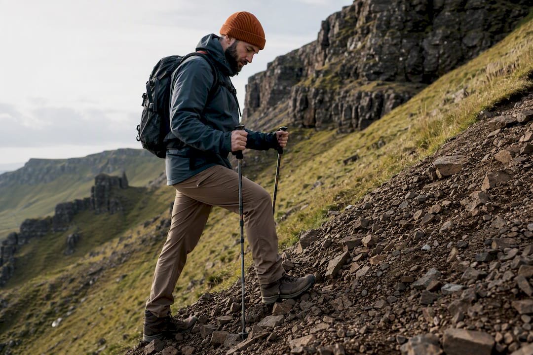
The full loop runs anticlockwise for most walkers starting from the summit car park, though some parties prefer clockwise to tackle the scramble on fresh legs. Either way, the landmarks are the same three: The Prison, The Needle, and The Table.
- From the car park to the first viewpoint. A clear path climbs gently along the base of the escarpment, giving you the first proper look at the jagged skyline that gives Quiraing its reputation.
- The approach to The Prison. This squat, castle-like rock formation appears after roughly 15 to 20 minutes. The path narrows here and the ground gets rockier underfoot.
- The Needle and the gully scramble. Shortly after The Prison, a steep, narrow gully cuts through the rock. This is the one genuine scramble on the route: hands-on-rock in places, with loose scree and exposed edges either side. It’s short but it demands attention.
- Onto the plateau and The Table. Beyond the gully, the path opens onto flatter ground. The Table is a hidden grassy plateau tucked behind the ridge, invisible from below, and reaching it means a short detour off the main circuit.
- The high traverse and return. The path continues along the ridge before dropping back towards the car park. Return sections are more eroded than the outbound leg, and mist can make the escarpment’s curve genuinely disorientating.
A few things worth flagging before you set off:
- The scramble near The Needle is unavoidable on the full circuit; there’s no sanitised bypass.
- Loose scree sits on several stretches of the return, particularly after rain.
- Cliff edges are close to the path in more places than photos suggest.
Getting to the Quiraing: parking and access
The Quiraing car park sits at the summit of the minor single track road linking Staffin and Uig, at Grid Ref NG440679. A parking charge applies, and there’s no direct public transport to the car park itself. The nearest bus stop is roughly 3 km away, so unless you’re driving or being dropped off, factor in a walk just to reach the start.
The car park is small, and in peak season it fills by mid morning. OutdoorScot’s guidance is blunt: don’t park on passing places or hairpin bends. These are the only spots two cars can pass on a single track road, and blocking one can strand emergency vehicles as easily as tourists.
Practical notes for the drive itself:
- The road between Staffin and Uig is single track with frequent hairpins, so allow more time than the distance suggests.
- From Portree, budget a moderate drive time to the car park.
- Combine the walk with Staffin Beach or the Kilt Rock viewpoint if you’re building a fuller Skye day.
- If the car park looks full, park lower down near Staffin and walk up rather than circling for a space.
Pro Tip: Arrive before 8am if you can. Not only does this beat the coach parties to the car park, it also tends to give the clearest light for photographs, since low cloud often lifts off the ridge by mid morning in summer.
If you’re building a longer day around the walk, our Isle of Skye day tour planning guide covers how to sequence Quiraing with other stops without rushing any of them.
What kit and safety precautions does the Quiraing hike need?
Sturdy footwear matters more here than on most Skye walks. The path shifts between grass, rock, scree and bog within a single stage, so trail shoes with poor grip get punished quickly on the descent.
Pack for:
- Proper walking boots with ankle support and good tread
- A waterproof shell and a warm mid layer, even in summer
- An OS Explorer 408 map and a compass, not just a phone
- A charged phone as backup, plus a power bank on longer days
On navigation: phone mapping apps are useful but not reliable in poor visibility, and GPS signal on the ridge can be patchy. The escarpment’s curve is genuinely easy to misread in mist, which is when a paper map and the ability to use it actually earn their keep.
Weather rules apply strictly here. Turn back, or don’t start, if there’s high wind, snow, or visibility under 50 metres, since exposed sections make a slip far more consequential than on a sheltered path. The Quiraing sits within an active landslip, and cliff edges and scree slopes shift with weather, so keep a firm distance from any edge, however solid it looks.
Pro Tip: Don’t attempt the scrambles up onto The Prison or The Needle themselves unless you have genuine scrambling experience. The circular route doesn’t require it, and most serious incidents here come from people leaving the path to “just get a better photo.”
For a broader kit list beyond this specific walk, see our guide on preparing for a Highlands adventure.
Shorter and longer options for the Quiraing loop walk
Not everyone needs the full 7 km. Three sensible variations:
- The short lookout out and back (roughly 3.5 km, 1 to 2 hours): walk to The Needle and back rather than completing the loop. This captures the iconic views with far less risk, since you skip the more exposed ridge return entirely. Good for families or anyone tight on time.
- The Flodigarry approach (around 11 km): starting lower, near Flodigarry, adds distance and a longer climb but avoids the crowded summit car park entirely. Better for experienced walkers wanting solitude over convenience.
- The Table detour: reaching the hidden plateau adds modest distance but sits beyond the gully scramble, so it’s only sensible for walkers already comfortable on exposed, loose ground.
What locals know about timing the Quiraing right
Guided groups treat the Quiraing differently to solo walkers, mostly around timing and pace rather than route choice. Arriving before 8am in summer isn’t just about parking; it usually means calmer light and stiller air on a ridge that can turn blustery by lunchtime, a pattern borne out by local guiding reports.
Group management matters too. On a narrow gully with a queue behind you, rushing the scramble causes more slips than the terrain itself. Guided parties tend to break the walk at The Prison rather than pushing straight through, giving slower members time to catch up before the trickiest ground.
One detail that surprises first timers: the escarpment looks the same from multiple angles once you’re on the plateau, which is exactly where solo walkers report losing the path in low cloud. A guide who’s walked the route dozens of times reads the terrain almost automatically. That’s the value a local eye adds beyond what any map can show.
Is there anywhere to eat or use a toilet near the Quiraing?
Facilities at the Quiraing car park itself are minimal to nonexistent, so plan accordingly before you leave Portree, Staffin or Uig. There’s no permanent toilet block at the summit car park and no café at the trailhead, which catches out walkers expecting Skye’s more developed sites like the Fairy Pools.
Staffin, roughly 15 minutes’ drive away, has the nearest reliable options: a small shop and a handful of places to grab food. Uig, on the other side of the ridge, has a hotel and a few eateries near the ferry terminal, useful if you’re finishing the drive there rather than looping back to Staffin.
Given the gap between facilities, carry water and snacks for the full walk rather than counting on finding anything en route. This isn’t a walk with cafés dotted along it. Toilet stops are best planned in Staffin or Portree before you head up the single track road, since the drive itself doesn’t pass anywhere suitable once you’re on the climb to the summit.
If you’re combining the Quiraing with a wider day out, our guide to things to do on Skye flags nearby villages with better facilities worth building into your route.
Why the Quiraing needs careful footsteps, not just good boots
The Quiraing sits inside one of the largest active landslips in Britain, which means the ground itself is still moving. Scree slopes shift after heavy rain, and sections of path erode faster here than on more geologically stable Skye walks, which is part of why route notes change year to year.
Straying off the marked path accelerates that erosion directly. Every shortcut across a switchback or detour around a boggy patch widens the scar and encourages the next walker to do the same, until a narrow footpath becomes a bare strip of bare earth visible from across the valley.
A few habits make a real difference:
- Stick to the worn path even where it’s muddy, rather than skirting round the edge.
- Take photographs from the path, not from unofficial vantage points beyond it.
- Carry out any litter, including biodegradable waste like fruit peel, which decomposes slowly at this altitude.
- Avoid disturbing loose scree, both for erosion and because it can be a hazard to walkers below.
None of this is about ticking a conservation box. The Quiraing’s appeal is precisely that it still looks wild and unmanaged, unlike more heavily boardwalked sites elsewhere on Skye. Keeping it that way depends on thousands of individual walkers making the same small, careful choices.
What wildlife might you see on the Quiraing walk?
Golden eagles nest in the wider Trotternish area, and sightings from the ridge, while never guaranteed, are far from rare on a clear day. Look up rather than only ahead; the birds tend to use thermals along the escarpment face, riding updrafts rather than flapping past at eye level.
Closer to the ground, red deer graze the lower slopes and are commonly spotted at dawn or dusk, exactly when the light is best for photography anyway. Give them a wide berth rather than approaching for a closer shot.
The plant life rewards a slower pace. Alpine and montane species cling to the rockier ground near The Needle, adapted to thin soil and constant wind, while the grassy plateau around The Table supports a noticeably different mix, closer to typical Skye moorland. Keep an eye out for heather in late summer, when the lower slopes turn a deep purple that photographs beautifully against the grey rock.
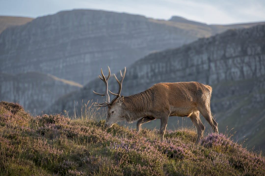
None of this wildlife is dangerous, which is one genuine relief on a walk that otherwise demands attention to terrain. The bigger risk to any of it is human traffic drifting off the path, which is exactly the erosion problem the route’s conservation guidance is built to prevent.
How do you avoid getting lost on the Quiraing circuit?
Signage on the Quiraing is minimal by design; this isn’t a boardwalked nature trail with arrows every hundred metres. The path itself is generally clear underfoot in good visibility, worn by decades of foot traffic, but that clarity disappears fast once cloud drops onto the ridge.
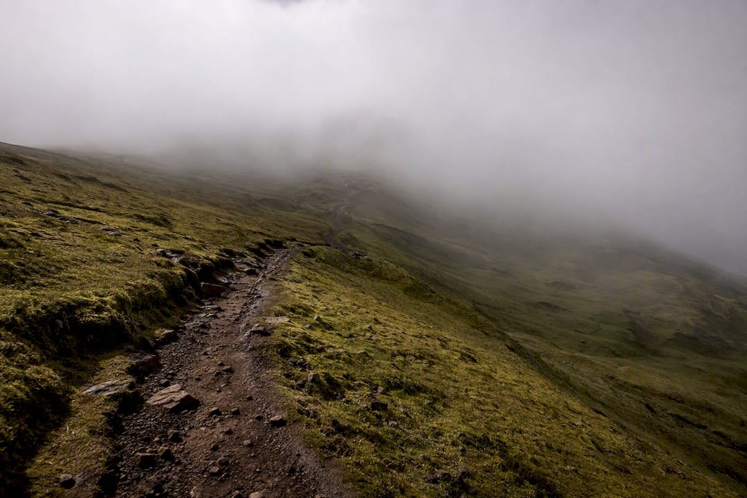
The main navigational trap is the escarpment’s curve. Because the cliff line bends gradually, walkers in mist can lose track of whether they’re heading back towards the car park or further along the ridge, since the terrain circling the plateau can look near identical from multiple points. This is exactly where a paper map and compass bearing beat a phone screen, particularly once GPS accuracy degrades near the rock walls.
Practical navigation habits that actually help:
- Note the time and direction you leave the car park, so you have a rough bearing to retrace if needed.
- Treat any unmarked side path as a dead end or a scrambler’s route, not a shortcut.
- If cloud drops suddenly, stop and reassess rather than pushing on hoping it clears.
- Tell someone your planned route and expected return time before setting off.
The safest rule on this walk is simple: if you can’t see the next landmark clearly, don’t guess which way the path goes.
Should you join a guided walk or hiking group for the Quiraing?
A guided walk removes most of the planning friction that trips up first time visitors: where to park when the summit car park is full, which fork in the path leads to The Table, and how to read the weather before it turns. For walkers uneasy about the scramble section or unfamiliar with exposed ridge terrain, that local knowledge is worth more than any guidebook.
Local hiking groups and organised walks exist across Skye, though most operate seasonally and require advance booking given limited group sizes. A private guide offers more flexibility: a start time built around the light and the tide of coach traffic, rather than a fixed departure that might land you in the middle of a July queue at the gully.
The trade off is straightforward. Independent walkers save money and set their own pace but carry the full weight of route finding, weather judgement and parking logistics themselves. A guided option costs more but hands that responsibility to someone who’s walked the ridge often enough to read it properly, which matters most exactly when conditions are marginal.
Either way, book ahead in peak season. Guided slots and car park space both run out well before the walk itself gets busy.
What the guidebooks get wrong about this walk
Most Quiraing write-ups treat the circuit as a single difficulty rating, when it’s actually three or four different walks stitched together. The gentle approach path, the scramble near The Needle, the exposed high traverse, and the eroded return each demand a different skill, and lumping them into one “moderate” grade does a disservice to anyone who’s fine on rocky ground but genuinely uneasy near a drop.
The bigger gap in conventional advice is timing. Guidebooks fixate on distance and ascent but say little about how parking pressure and cloud cover interact. Arrive at 10am on a July Saturday and you’re not just fighting for a parking spot; you’re also more likely to hit the ridge after the morning clarity has burned off into haze.
My honest read: prioritise arrival time over almost everything else on this walk. Get there early, and a lot of the difficulty this article describes simply doesn’t apply, because you’re walking an empty path in still air rather than queuing behind twenty people at a narrow gully in a rising wind.
— Alin
Consider a guided visit if the logistics worry you more than the walk
If the parking squeeze, the gully scramble, or navigating a misty ridge sound like the parts that could ruin your day rather than the walk itself, a private guide removes exactly those variables. Private guided days on Skye can be arranged to suit your pace and the day’s weather window, rather than a fixed departure time that might land you at the car park just as the coaches do.

Tours can be tailored to group size and ability, so a family wanting the short lookout view might have a different itinerary to a confident walker aiming for the full circuit and The Table. Knowledge of the current state of the scramble, car park status, and morning light conditions can help plan visits. Using arranged transport may help avoid the stress of single track driving.
Check availability and enquire about a private Highlands tour to build a Quiraing day around your dates and pace.
Sources
- Komoot highlight: The Quiraing
- Highland Council directory: Skye — The Quiraing
- WalkHighlands — Quiraing, hill circuit
- OutdoorScot — Quiraing parking guidance
FAQ
How difficult is the Quiraing hike?
It’s moderate to challenging: narrow, rocky paths, loose scree, exposed cliff edges, and one minor scramble near The Needle. Fit walkers with sturdy boots manage it comfortably in good weather, but poor visibility or wind raises the difficulty sharply.
Where does the Quiraing hike start?
The full circuit starts at the car park at the summit of the minor road between Staffin and Uig, at Grid Ref NG440679. A parking charge applies and the car park is small, so arriving early matters.
How long does the Quiraing loop take?
Most walkers complete the 6.5 to 7.1 km circuit in 2 to 4 hours, depending on fitness, photo stops and weather. The shorter out and back to The Needle takes roughly 1 to 2 hours.
Can you see the Quiraing without hiking?
Yes. The car park itself gives a striking first view of the escarpment, and a short walk of only a few minutes along the path opens up much more without committing to the full loop or the scramble section.
Is it worth hiring a guide for the Quiraing?
A guide is genuinely useful if you’re unsure about the scramble, worried about parking, or visiting when weather looks marginal, since local knowledge of current conditions beats any static guidebook description.